
Centenario topographic map
Interactive map
Click on the map to display elevation.
About this map
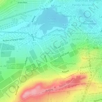
Name: Centenario topographic map, elevation, terrain.
Average elevation: 151 ft
Minimum elevation: 7 ft
Maximum elevation: 456 ft
Other topographic maps
Click on a map to view its topography, its elevation and its terrain.
Solo
Argentina > Santa Cruz > Humedal
Solo, Humedal, Caleta Olivia, Deseado, Santa Cruz, 9011, Argentina
Average elevation: 112 ft