Geolocate

Ranipet topographic map

Click on the map to display elevation.

About this map

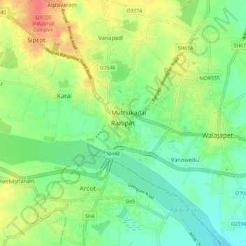
Name: Ranipet topographic map, elevation, terrain.

Location: Ranipet, Wallajah, Ranipet District, Tamil Nadu, 632401, India (12.88925 79.29217 12.96925 79.37217)

Average elevation: 564 ft

Minimum elevation: 495 ft

Maximum elevation: 666 ft

Gear up for your next adventure:

❄️Traction Cleats - Prevent slips on icy trails during winter hikes
🛰️Handheld GPS Units - Professional satellite navigators for precise backcountry mapping
🦶Carbon Trekking Poles - Reduce knee impact on steep descents with ultra-light poles
🔋Solar Power Banks - Keep your GPS and phone charged in remote wilderness areas
🦟Ultrasonic Repellers - Create a bug-free zone at your camp or rest stop

As an Amazon Associate, this site earns from qualifying purchases at no extra cost to you.