
Lake Isabella topographic map
Click on the map to display elevation.
Lake Isabella
The town of Lake Isabella is located 35 miles (56 km) east-northeast of Bakersfield, at an elevation of 2,513 feet (766 m). The population was 3,573 at the 2020 census, up from 3,466 at the 2010 census.
About this map
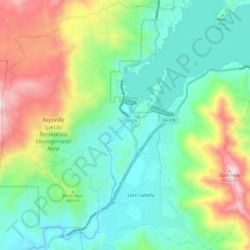
Name: Lake Isabella topographic map, elevation, terrain.
Location: Lake Isabella, Kern County, California, United States (35.59406 -118.53623 35.68126 -118.43083)
Average elevation: 3,261 ft
Minimum elevation: 2,313 ft
Maximum elevation: 5,361 ft
Kern County trails, hiking, mountain biking, running and outdoor activities