
Tuni topographic map
Interactive map
Click on the map to display elevation.
About this map
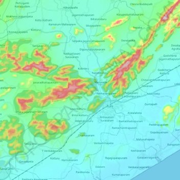
Name: Tuni topographic map, elevation, terrain.
Location: Tuni, East Godavari, Andhra Pradesh, India (17.26927 82.42227 17.49407 82.60489)
Average elevation: 259 ft
Minimum elevation: -3 ft
Maximum elevation: 1,539 ft
Other topographic maps
Click on a map to view its topography, its elevation and its terrain.
Cinnamenettipalli
India > Andhra Pradesh > Cinnamenettipalli
Cinnamenettipalli, Kurnool, Andhra Pradesh, India
Average elevation: 1,322 ft