
Gümüşpala Mahallesi topographic map
Interactive map
Click on the map to display elevation.
About this map
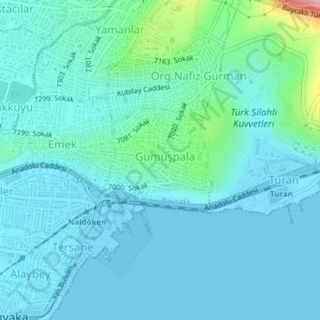
Name: Gümüşpala Mahallesi topographic map, elevation, terrain.
Location: Gümüşpala Mahallesi, Bayraklı, Izmir, Aegean Region, Turkey (38.46445 27.12983 38.47333 27.14197)
Average elevation: 115 ft
Minimum elevation: -7 ft
Maximum elevation: 837 ft
Other topographic maps
Click on a map to view its topography, its elevation and its terrain.