
Oraison topographic map
Interactive map
Click on the map to display elevation.
About this map
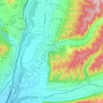
Name: Oraison topographic map, elevation, terrain.
Average elevation: 1,368 ft
Minimum elevation: 1,056 ft
Maximum elevation: 2,142 ft
Karakteristieken van de brug: lengte: 14 m Hoogte onder de boog: 2.50 Breedte van het voetgangerspad: 1.70 m.