
Bekkevoort topographic map
Interactive map
Click on the map to display elevation.
About this map
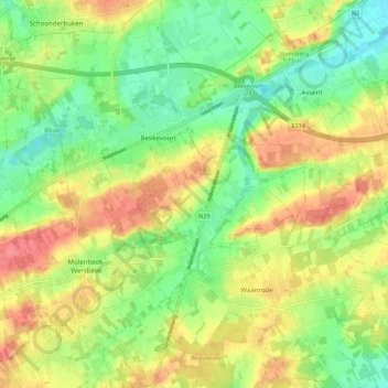
Name: Bekkevoort topographic map, elevation, terrain.
Location: Bekkevoort, Leuven, Flemish Brabant, 3460, Belgium (50.89946 4.93352 50.96844 5.02015)
Average elevation: 174 ft
Minimum elevation: 72 ft
Maximum elevation: 282 ft