Geolocate

São Torcato topographic map

Click on the map to display elevation.

About this map

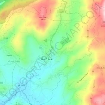
Name: São Torcato topographic map, elevation, terrain.

Location: São Torcato, Guimarães, Braga, Portugal (41.46406 -8.28456 41.50395 -8.23455)

Average elevation: 1,030 ft

Minimum elevation: 584 ft

Maximum elevation: 1,680 ft

Other topographic maps

Click on a map to view its topography, its elevation and its terrain.

Guimarães

Portugal > Braga > Guimarães

Average elevation: 981 ft

Além

Portugal > Braga > Guimarães > Sande (Vila Nova)

Average elevation: 472 ft

Gear up for your next adventure:

🔭Compact Binoculars - HD vision for scouting terrain and identifying distant landmarks
📚Navigation Handbooks - Master the art of reading topographic maps and using a compass
🗻Climbing Gear Basics - Essential gear for beginner climbers
🩹Survival Bandages - High‑quality bandages for emergencies
📚USA Hiking Guide Books - Top trail guides and map books

As an Amazon Associate, this site earns from qualifying purchases at no extra cost to you.