
Cape Horn topographic map
Interactive map
Click on the map to display elevation.
About this map
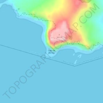
Name: Cape Horn topographic map, elevation, terrain.
Average elevation: 161 ft
Minimum elevation: -3 ft
Maximum elevation: 1,063 ft
Other topographic maps
Click on a map to view its topography, its elevation and its terrain.
Sanderson
Chile > Region of Magallanes and Chilean Antarctica > Cape Horn
Sanderson, Cape Horn, Provincia de la Antártica Chilena, Region of Magallanes and Chilean Antarctica, Chile
Average elevation: 56 ft