
Loch Creran Marine Protected Area topographic map
Interactive map
Click on the map to display elevation.
About this map
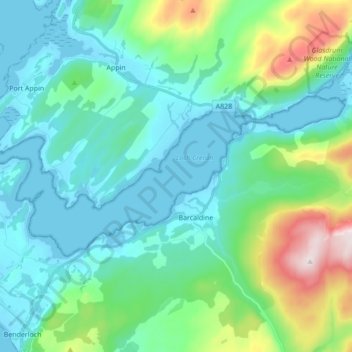
Name: Loch Creran Marine Protected Area topographic map, elevation, terrain.
Average elevation: 463 ft
Minimum elevation: -3 ft
Maximum elevation: 2,300 ft