
Le Giraldès topographic map
Interactive map
Click on the map to display elevation.
About this map
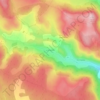
Name: Le Giraldès topographic map, elevation, terrain.
Average elevation: 4,508 ft
Minimum elevation: 3,957 ft
Maximum elevation: 4,833 ft
Other topographic maps
Click on a map to view its topography, its elevation and its terrain.
Lac de Charpal
France > Occitanie > Lozère > Arzenc-de-Randon
Lac de Charpal, Rieutort-de-Randon, Arzenc-de-Randon, Mende, Lozère, Occitanie, France métropolitaine, 48170, France
Average elevation: 4,413 ft
Granouillac
France > Occitanie > Lozère > Arzenc-de-Randon
Granouillac, Arzenc-de-Randon, Mende, Lozère, Occitanie, France métropolitaine, 48170, France
Average elevation: 4,016 ft