
Otwock topographic map
Interactive map
Click on the map to display elevation.
About this map
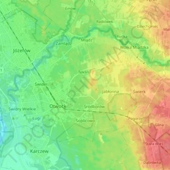
Name: Otwock topographic map, elevation, terrain.
Location: Otwock, Otwock County, Masovian Voivodeship, Poland (52.08341 21.21033 52.14877 21.36836)
Average elevation: 341 ft
Minimum elevation: 262 ft
Maximum elevation: 463 ft