
Karlskrona kommun topographic map
Interactive map
Click on the map to display elevation.
About this map
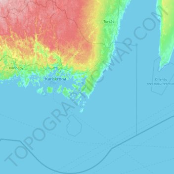
Name: Karlskrona kommun topographic map, elevation, terrain.
Location: Karlskrona kommun, Blekinge County, Sweden (55.74673 15.23061 56.50351 16.22367)
Average elevation: 82 ft
Minimum elevation: -7 ft
Maximum elevation: 522 ft
Other topographic maps
Click on a map to view its topography, its elevation and its terrain.
Ronneby kommun
Ronneby kommun, Blekinge County, Sweden
Average elevation: 148 ft
Karlshamn
Karlshamn, Karlshamns kommun, Blekinge County, 374 36, Sweden
Average elevation: 46 ft