
寨乪 topographic map
Interactive map
Click on the map to display elevation.
About this map
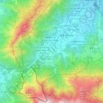
Name: 寨乪 topographic map, elevation, terrain.
Location: 寨乪, 梧桐寨村, 大埔區, 新界, 香港, 中国 (22.42153 114.10877 22.46153 114.14877)
Average elevation: 768 ft
Minimum elevation: 33 ft
Maximum elevation: 2,133 ft
Other topographic maps
Click on a map to view its topography, its elevation and its terrain.