
Bouchrahil topographic map
Interactive map
Click on the map to display elevation.
About this map
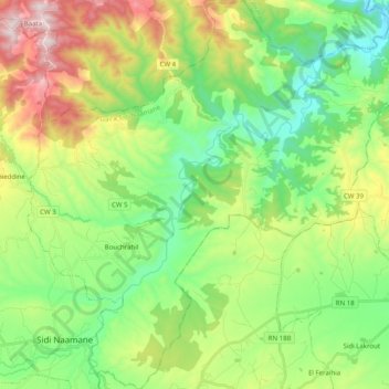
Name: Bouchrahil topographic map, elevation, terrain.
Location: Bouchrahil, Daïra Sidi Naamane, Médéa, Algérie (36.19407 3.10751 36.35529 3.30213)
Average elevation: 2,274 ft
Minimum elevation: 1,365 ft
Maximum elevation: 4,049 ft
Other topographic maps
Click on a map to view its topography, its elevation and its terrain.
Ouled Rahmoune
Algérie > Médéa > Daïra Sidi Naamane
Ouled Rahmoune, Khams Djouamaa, Daïra Sidi Naamane, Médéa, Algérie
Average elevation: 2,185 ft