
Ruinen topographic map
Interactive map
Click on the map to display elevation.
About this map
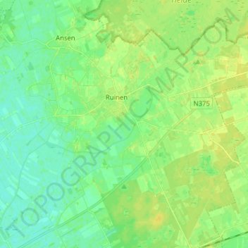
Name: Ruinen topographic map, elevation, terrain.
Location: Ruinen, De Wolden, Drente, Niederlande (52.72319 6.30485 52.78832 6.43236)
Average elevation: 26 ft
Minimum elevation: 0 ft
Maximum elevation: 49 ft
Other topographic maps
Click on a map to view its topography, its elevation and its terrain.
Echten
Niederlande > Drente > De Wolden
Echten, De Wolden, Drente, Niederlande
Average elevation: 26 ft
Ruinerwold
Niederlande > Drente > De Wolden
Ruinerwold, De Wolden, Drente, Niederlande
Average elevation: 10 ft
Drogteropslagen
Niederlande > Drente > De Wolden
Drogteropslagen, De Wolden, Drente, Niederlande
Average elevation: 26 ft