
Jainagar topographic map
Interactive map
Click on the map to display elevation.
About this map
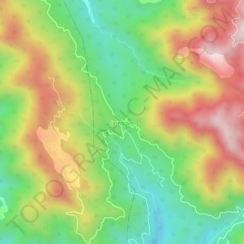
Name: Jainagar topographic map, elevation, terrain.
Location: Jainagar, Arki, Solan District, Himachal Pradesh, India (31.15477 76.82986 31.19477 76.86986)
Average elevation: 3,953 ft
Minimum elevation: 2,799 ft
Maximum elevation: 5,358 ft
Other topographic maps
Click on a map to view its topography, its elevation and its terrain.
Kunihar
India > Himachal Pradesh > Arki > Kunihar
Kunihar, Arki, Solan, Himachal Pradesh, 173208, India
Average elevation: 3,136 ft