
Deepcut topographic map
Interactive map
Click on the map to display elevation.
About this map
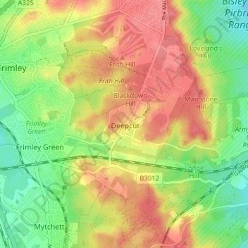
Name: Deepcut topographic map, elevation, terrain.
Location: Deepcut, Surrey, South East, England, GU16 6QU, United Kingdom (51.28635 -0.72624 51.32635 -0.68624)
Average elevation: 289 ft
Minimum elevation: 171 ft
Maximum elevation: 394 ft