
Lac Qinghai topographic map
Interactive map
Click on the map to display elevation.
About this map
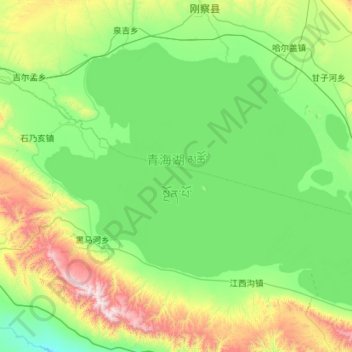
Name: Lac Qinghai topographic map, elevation, terrain.
Location: Lac Qinghai, གསེར་ཆེན་རྫོང 共和县, 海南州, Qinghai, RPC (36.54925 99.62175 37.23275 100.75875)
Average elevation: 10,932 ft
Minimum elevation: 9,859 ft
Maximum elevation: 15,210 ft
Other topographic maps
Click on a map to view its topography, its elevation and its terrain.