
安波街道 topographic map
Interactive map
Click on the map to display elevation.
About this map
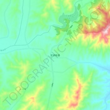
Name: 安波街道 topographic map, elevation, terrain.
Location: 安波街道, 普兰店区, 大连市, 辽宁省, 中国 (39.79640 122.26907 39.87640 122.34907)
Average elevation: 669 ft
Minimum elevation: 272 ft
Maximum elevation: 1,778 ft