
Bleibeskopf topographic map
Interactive map
Click on the map to display elevation.
About this map
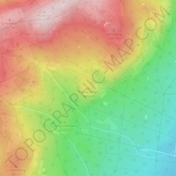
Name: Bleibeskopf topographic map, elevation, terrain.
Average elevation: 1,490 ft
Minimum elevation: 906 ft
Maximum elevation: 2,087 ft
Other topographic maps
Click on a map to view its topography, its elevation and its terrain.
Ober-Erlenbach
Deutschland > Hessen > Hochtaunuskreis > Bad Homburg vor der Höhe
Ober-Erlenbach, Bad Homburg vor der Höhe, Hochtaunuskreis, Hessen, Deutschland
Average elevation: 509 ft