
East Branch Au Sable River topographic map
Interactive map
Click on the map to display elevation.
About this map
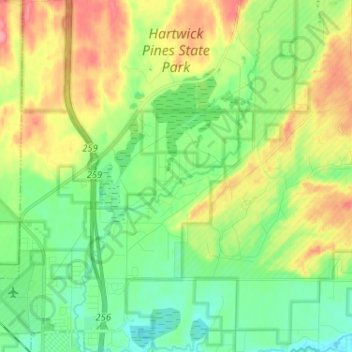
Name: East Branch Au Sable River topographic map, elevation, terrain.
Average elevation: 1,194 ft
Minimum elevation: 1,096 ft
Maximum elevation: 1,348 ft
Other topographic maps
Click on a map to view its topography, its elevation and its terrain.
Grayling
United States > Michigan > Crawford County > Grayling
Grayling, Crawford County, Michigan, United States
Average elevation: 1,142 ft