
St. Radegund topographic map
Interactive map
Click on the map to display elevation.
About this map
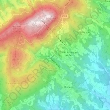
Name: St. Radegund topographic map, elevation, terrain.
Average elevation: 2,746 ft
Minimum elevation: 1,545 ft
Maximum elevation: 4,751 ft
Im Gemeindegebiet befinden sich mit dem Zwölferkogel (1192 m), der Erhardhöhe (1049 m) und dem Hohenberg (1048 m) drei weitere Gipfel über 1000 m.
Other topographic maps
Click on a map to view its topography, its elevation and its terrain.
Rinnegg
Österreich > Steiermark > St. Radegund > Rinnegg
Rinnegg, St. Radegund, Bezirk Graz-Umgebung, Steiermark, 8061, Österreich
Average elevation: 2,021 ft