
Jacó topographic map
Interactive map
Click on the map to display elevation.
About this map
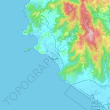
Name: Jacó topographic map, elevation, terrain.
Location: Jacó, Cantón Garabito, Provincia Puntarenas, 61101, Costa Rica (9.53603 -84.68013 9.70407 -84.52835)
Average elevation: 453 ft
Minimum elevation: -3 ft
Maximum elevation: 2,635 ft