
Taray topographic map
Interactive map
Click on the map to display elevation.
About this map
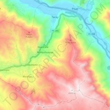
Name: Taray topographic map, elevation, terrain.
Location: Taray, Provincia de Calca, Cuzco, Perú (-13.49937 -71.93167 -13.41658 -71.84135)
Average elevation: 12,211 ft
Minimum elevation: 9,682 ft
Maximum elevation: 14,826 ft
La capital es el poblado de Taray, situado a 2900 de altitud.