
Sesheke topographic map
Interactive map
Click on the map to display elevation.
About this map
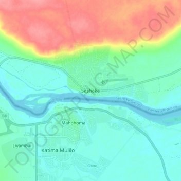
Name: Sesheke topographic map, elevation, terrain.
Location: Sesheke, Sesheke District, Western Province, Zambia (-17.52095 24.25447 -17.44095 24.33447)
Average elevation: 3,146 ft
Minimum elevation: 3,064 ft
Maximum elevation: 3,327 ft
Other topographic maps
Click on a map to view its topography, its elevation and its terrain.
Kaoma
Kaoma, Kaoma District, Western Province, Zambia
Average elevation: 3,806 ft