
Jabal Sawda topographic map
Interactive map
Click on the map to display elevation.
About this map
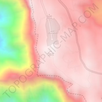
Name: Jabal Sawda topographic map, elevation, terrain.
Location: Jabal Sawda, Abha, 'Asir Region, Saudi Arabia (18.26554 42.36751 18.26564 42.36761)
Average elevation: 9,098 ft
Minimum elevation: 6,962 ft
Maximum elevation: 9,826 ft
Other topographic maps
Click on a map to view its topography, its elevation and its terrain.
Jabal Rujm
Jabal Rujm, Abha, 'Asir Region, Saudi Arabia
Average elevation: 7,267 ft