
Thank you for supporting this site ❤️
Make a donation
Make a donation
Gear up for your next adventure:
As an Amazon Associate, this site earns from qualifying purchases at no extra cost to you.
Salgesch topographic map
Click on the map to display elevation.
Thank you for supporting this site ❤️
Make a donation
Make a donation
Gear up for your next adventure:
As an Amazon Associate, this site earns from qualifying purchases at no extra cost to you.
About this map
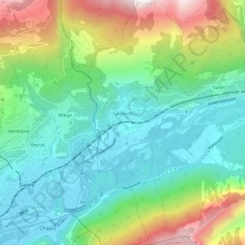
Name: Salgesch topographic map, elevation, terrain.
Location: Salgesch, Leuk, Wallis, 3970, Switzerland (46.27591 7.55011 46.34225 7.59441)
Average elevation: 3,212 ft
Minimum elevation: 1,696 ft
Maximum elevation: 7,005 ft
Thank you for supporting this site ❤️
Make a donation
Make a donation
Gear up for your next adventure:
As an Amazon Associate, this site earns from qualifying purchases at no extra cost to you.