
Le Schiene topographic map
Interactive map
Click on the map to display elevation.
About this map
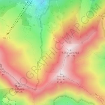
Name: Le Schiene topographic map, elevation, terrain.
Location: Le Schiene, Triora, Imperia, Ligurien, 18025, Italien (44.05068 7.74372 44.07068 7.76372)
Average elevation: 5,909 ft
Minimum elevation: 4,478 ft
Maximum elevation: 6,962 ft