
Vredepeel topographic map
Interactive map
Click on the map to display elevation.
About this map
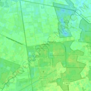
Name: Vredepeel topographic map, elevation, terrain.
Location: Vredepeel, Venray, Limburg, Nederland (51.51084 5.83824 51.56641 5.91943)
Average elevation: 92 ft
Minimum elevation: 72 ft
Maximum elevation: 108 ft
Other topographic maps
Click on a map to view its topography, its elevation and its terrain.
Zwarteklef
Zwarteklef, Venray, Limburg, Nederland, 5804 BJ, Nederland
Average elevation: 79 ft