
Independencia topographic map
Interactive map
Click on the map to display elevation.
About this map
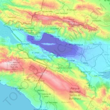
Name: Independencia topographic map, elevation, terrain.
Location: Independencia, Dominican Republic (18.13787 -72.01147 18.69179 -71.21136)
Average elevation: 2,215 ft
Minimum elevation: -144 ft
Maximum elevation: 8,688 ft