
Weihai topographic map
Interactive map
Click on the map to display elevation.
About this map
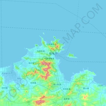
Name: Weihai topographic map, elevation, terrain.
Location: Weihai, 环翠区 (Huancui), 威海市, Shandong, 264200, Chine (37.35210 121.95526 37.67210 122.27526)
Average elevation: 82 ft
Minimum elevation: -10 ft
Maximum elevation: 1,319 ft