
喀纳斯湖 topographic map
Interactive map
Click on the map to display elevation.
About this map
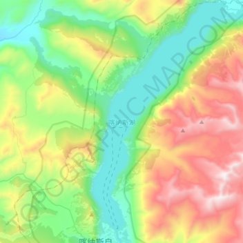
Name: 喀纳斯湖 topographic map, elevation, terrain.
Location: 喀纳斯湖, 禾木哈纳斯蒙古民族乡, 布尔津县, Алтай 阿勒泰地区, Xinjiang, RPC (48.70250 86.99212 48.89600 87.15605)
Average elevation: 6,220 ft
Minimum elevation: 4,354 ft
Maximum elevation: 9,849 ft