
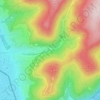
Mühlbach topographic map
Interactive map
Click on the map to display elevation.
About this map
Name: Mühlbach topographic map, elevation, terrain.
Average elevation: 965 ft
Minimum elevation: 351 ft
Maximum elevation: 1,690 ft
Other topographic maps
Click on a map to view its topography, its elevation and its terrain.
Heidelberg
Allemagne > Bade-Wurtemberg > Heidelberg
Heidelberg, Regierungsbezirk Karlsruhe, Bade-Wurtemberg, 69120, Allemagne
Average elevation: 656 ft