
Ethe topographic map
Interactive map
Click on the map to display elevation.
About this map
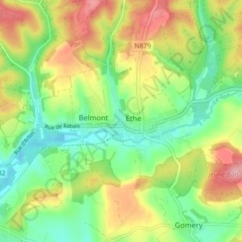
Name: Ethe topographic map, elevation, terrain.
Location: Ethe, Virton, Luxembourg, Wallonia, 6760, Belgium (49.56142 5.55669 49.60142 5.59669)
Average elevation: 837 ft
Minimum elevation: 673 ft
Maximum elevation: 1,060 ft