
Bluff Hill topographic map
Interactive map
Click on the map to display elevation.
About this map
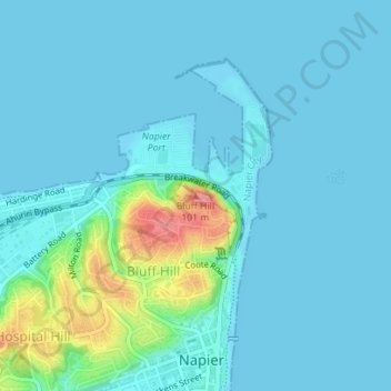
Name: Bluff Hill topographic map, elevation, terrain.
Location: Bluff Hill, Napier, Hawke's Bay, 4001, New Zealand (-39.47894 176.91724 -39.47884 176.91734)
Average elevation: 46 ft
Minimum elevation: -3 ft
Maximum elevation: 328 ft
Other topographic maps
Click on a map to view its topography, its elevation and its terrain.
Pirimai
New Zealand > Hawke's Bay > Napier
Pirimai, Napier, Hawke's Bay, New Zealand
Average elevation: 13 ft