
Nabeul topographic map
Interactive map
Click on the map to display elevation.
About this map
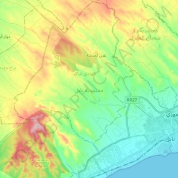
Name: Nabeul topographic map, elevation, terrain.
Location: Nabeul, 8000, Tunisie (36.42613 10.61083 36.53885 10.75276)
Average elevation: 364 ft
Minimum elevation: -3 ft
Maximum elevation: 1,056 ft
Other topographic maps
Click on a map to view its topography, its elevation and its terrain.