
Thank you for supporting this site ❤️
Make a donation
Make a donation
Gear up for your next adventure:
As an Amazon Associate, this site earns from qualifying purchases at no extra cost to you.
Carabanchel topographic map
Click on the map to display elevation.
Thank you for supporting this site ❤️
Make a donation
Make a donation
Gear up for your next adventure:
As an Amazon Associate, this site earns from qualifying purchases at no extra cost to you.
About this map
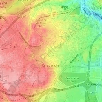
Name: Carabanchel topographic map, elevation, terrain.
Location: Carabanchel, Madrid, Community of Madrid, Spain (40.35726 -3.77162 40.40552 -3.70464)
Average elevation: 2,100 ft
Minimum elevation: 1,886 ft
Maximum elevation: 2,267 ft
Thank you for supporting this site ❤️
Make a donation
Make a donation
Gear up for your next adventure:
As an Amazon Associate, this site earns from qualifying purchases at no extra cost to you.