
Thank you for supporting this site ❤️
Make a donation
Make a donation
Gear up for your next adventure:
As an Amazon Associate, this site earns from qualifying purchases at no extra cost to you.
Trogen topographic map
Click on the map to display elevation.
Thank you for supporting this site ❤️
Make a donation
Make a donation
Gear up for your next adventure:
As an Amazon Associate, this site earns from qualifying purchases at no extra cost to you.
About this map
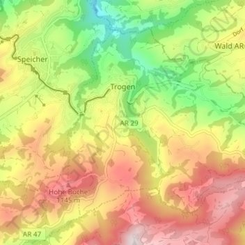
Name: Trogen topographic map, elevation, terrain.
Location: Trogen, Mittelland, Appenzell Ausserrhoden, 9043, Switzerland (47.38581 9.45112 47.41784 9.51231)
Average elevation: 3,136 ft
Minimum elevation: 2,208 ft
Maximum elevation: 4,052 ft
Thank you for supporting this site ❤️
Make a donation
Make a donation
Gear up for your next adventure:
As an Amazon Associate, this site earns from qualifying purchases at no extra cost to you.