
Nordstemmen topographic map
Interactive map
Click on the map to display elevation.
About this map
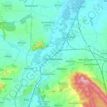
Name: Nordstemmen topographic map, elevation, terrain.
Location: Nordstemmen, Landkreis Hildesheim, Lower Saxony, 31171, Germany (52.11834 9.68556 52.21426 9.86412)
Average elevation: 328 ft
Minimum elevation: 200 ft
Maximum elevation: 928 ft
Other topographic maps
Click on a map to view its topography, its elevation and its terrain.
Alfeld (Leine)
Germany > Lower Saxony > Landkreis Hildesheim
Alfeld (Leine), Landkreis Hildesheim, Lower Saxony, 31061, Germany
Average elevation: 627 ft
Detfurth
Germany > Lower Saxony > Landkreis Hildesheim > Bad Salzdetfurth
Detfurth, Bad Salzdetfurth, Landkreis Hildesheim, Lower Saxony, 31162, Germany
Average elevation: 518 ft
Hildesheim
Germany > Lower Saxony > Landkreis Hildesheim
Hildesheim, Landkreis Hildesheim, Lower Saxony, Germany
Average elevation: 394 ft