Geolocate

Hanging Rock topographic map

Click on the map to display elevation.

About this map

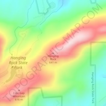
Name: Hanging Rock topographic map, elevation, terrain.

Location: Hanging Rock, Stokes County, North Carolina, United States (36.39592 -80.25621 36.39602 -80.25611)

Average elevation: 1,512 ft

Minimum elevation: 1,024 ft

Maximum elevation: 2,103 ft

Stokes County trails, hiking, mountain biking, running and outdoor activities

Gear up for your next adventure:

📖Nature Tracking Books - Learn to track wildlife and terrain
🧦Merino Wool Socks - Moisture-wicking, blister-preventing socks for long treks
🧢Outdoor Hiking Hat - Sun protection hat for outdoor explorers
🧭Outdoor Navigation Book - Learn advanced navigation skills
🔥Plasma Lighters - Windproof lighters that work in any weather condition

As an Amazon Associate, this site earns from qualifying purchases at no extra cost to you.