
Lake Numiti topographic map
Interactive map
Click on the map to display elevation.
About this map
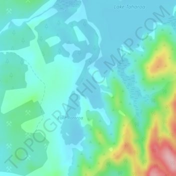
Name: Lake Numiti topographic map, elevation, terrain.
Average elevation: 135 ft
Minimum elevation: 13 ft
Maximum elevation: 607 ft
Other topographic maps
Click on a map to view its topography, its elevation and its terrain.
Lake Harihari
New Zealand > Waikato > Taharoa
Lake Harihari, Taharoa Road, Taharoa, Waitomo District, Waikato, New Zealand
Average elevation: 180 ft
Lake Rototapu
New Zealand > Waikato > Taharoa
Lake Rototapu, Taharoa Road, Taharoa, Waitomo District, Waikato, New Zealand
Average elevation: 102 ft
Lake Taharoa
New Zealand > Waikato > Taharoa
Lake Taharoa, Rotopuhoe Road, Taharoa, Waitomo District, Waikato, New Zealand
Average elevation: 121 ft