
Lievelde topographic map
Interactive map
Click on the map to display elevation.
About this map
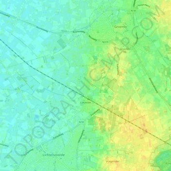
Name: Lievelde topographic map, elevation, terrain.
Location: Lievelde, Oost Gelre, Geldern, Niederlande (51.99773 6.53912 52.03799 6.65513)
Average elevation: 79 ft
Minimum elevation: 52 ft
Maximum elevation: 125 ft
Other topographic maps
Click on a map to view its topography, its elevation and its terrain.
Oost Gelre
Niederlande > Geldern > Oost Gelre
Oost Gelre, Geldern, Niederlande
Average elevation: 75 ft