
Kami topographic map
Interactive map
Click on the map to display elevation.
About this map
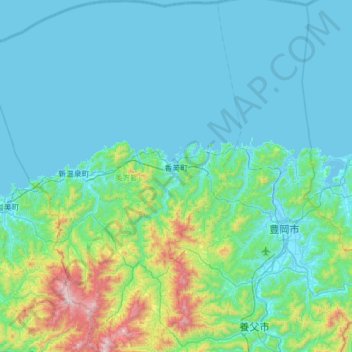
Name: Kami topographic map, elevation, terrain.
Location: Kami, 美方郡, Préfecture de Hyōgo, Japon (35.36586 134.41748 35.87016 134.74380)
Average elevation: 564 ft
Minimum elevation: -10 ft
Maximum elevation: 4,252 ft