
崮云湖街道 topographic map
Interactive map
Click on the map to display elevation.
About this map
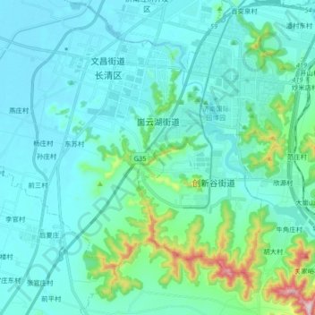
Name: 崮云湖街道 topographic map, elevation, terrain.
Location: 崮云湖街道, 长清区, 济南市, 山东省, 250300, 中国 (36.45360 116.76199 36.58488 116.89529)
Average elevation: 305 ft
Minimum elevation: 102 ft
Maximum elevation: 1,575 ft
Other topographic maps
Click on a map to view its topography, its elevation and its terrain.