
Carter Caves State Resort Park topographic map
Interactive map
Click on the map to display elevation.
About this map
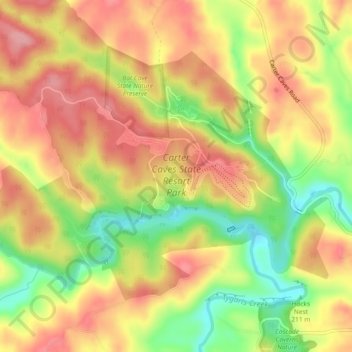
Name: Carter Caves State Resort Park topographic map, elevation, terrain.
Average elevation: 919 ft
Minimum elevation: 692 ft
Maximum elevation: 1,083 ft
Other topographic maps
Click on a map to view its topography, its elevation and its terrain.
Fultz
United States > Kentucky > Carter County
Fultz, Carter County, Kentucky, United States
Average elevation: 771 ft
Denton
United States > Kentucky > Carter County
Denton, Carter County, Kentucky, 41132, United States
Average elevation: 761 ft
Hayward
United States > Kentucky > Carter County > Hayward
Hayward, Carter County, Kentucky, 41173, United States
Average elevation: 1,047 ft
Grahn
United States > Kentucky > Carter County
Grahn, Carter County, Kentucky, 41142, United States
Average elevation: 873 ft