
Narharpur topographic map
Interactive map
Click on the map to display elevation.
About this map
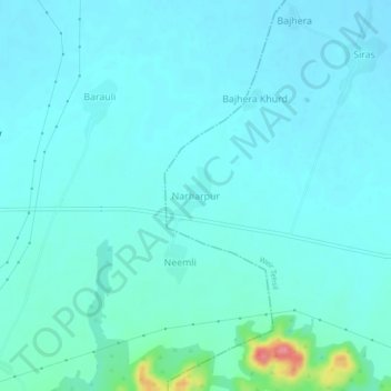
Name: Narharpur topographic map, elevation, terrain.
Average elevation: 738 ft
Minimum elevation: 699 ft
Maximum elevation: 997 ft
Other topographic maps
Click on a map to view its topography, its elevation and its terrain.
Bhopar
India > Rajasthan > Weir Tehsil
Bhopar, Weir Tehsil, Bharatpur District, Rajasthan, 321408, India
Average elevation: 699 ft