
Thank you for supporting this site ❤️
Make a donation
Make a donation
Gear up for your next adventure:
As an Amazon Associate, this site earns from qualifying purchases at no extra cost to you.
Fraijanes topographic map
Click on the map to display elevation.
Thank you for supporting this site ❤️
Make a donation
Make a donation
Gear up for your next adventure:
As an Amazon Associate, this site earns from qualifying purchases at no extra cost to you.
About this map
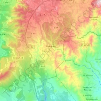
Name: Fraijanes topographic map, elevation, terrain.
Location: Fraijanes, Guatemala Department, 01052, Guatemala (14.36375 -90.49086 14.54456 -90.39080)
Average elevation: 4,898 ft
Minimum elevation: 3,228 ft
Maximum elevation: 7,188 ft
Thank you for supporting this site ❤️
Make a donation
Make a donation
Gear up for your next adventure:
As an Amazon Associate, this site earns from qualifying purchases at no extra cost to you.