
Espiritu Santo topographic map
Interactive map
Click on the map to display elevation.
About this map
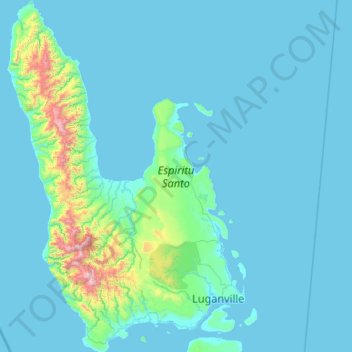
Name: Espiritu Santo topographic map, elevation, terrain.
Location: Espiritu Santo, Sanma, Vanuatu (-15.66892 166.54179 -14.64364 167.25961)
Average elevation: 371 ft
Minimum elevation: 0 ft
Maximum elevation: 5,965 ft
Other topographic maps
Click on a map to view its topography, its elevation and its terrain.