
Jaris topographic map
Interactive map
Click on the map to display elevation.
About this map
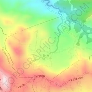
Name: Jaris topographic map, elevation, terrain.
Location: Jaris, Cantón Mora, San Jose Province, 10706, Costa Rica (9.86265 -84.29746 9.88614 -84.26623)
Average elevation: 2,795 ft
Minimum elevation: 1,916 ft
Maximum elevation: 3,717 ft
Other topographic maps
Click on a map to view its topography, its elevation and its terrain.
Piedras Negras
Piedras Negras, Cantón Mora, San Jose Province, 10704, Costa Rica
Average elevation: 2,156 ft